Forest cover decline in Assam: APSC Current Affairs Notes and MCQs
APSC CCE current affairs notes on Forest cover decline in Assam, from The Assam Tribune of 5 November 2026, with 4 practice MCQs for Prelims.
 For working professionals and full-time aspirantsAPSC CCE Foundation Programme₹24,999
Current Affairs Notes
From The Assam Tribune, 5 November 2026
Assam Forest Cover Decline and Unclassed State Forests
Syllabus Mapping
- Prelims: GS Paper I (General issues on Environment, ecology and climate change; Current events of State, National and International importance).
- Mains: GS Paper III (Conservation, environmental pollution and degradation, environmental impact assessment); GS Paper V (Assam: environment, forests and natural resources; Sixth Schedule and autonomous councils).
Why in News? The Assam government has filed an affidavit before the National Green Tribunal (NGT). It is about the forest loss shown in the India State of Forest Report (ISFR) 2023. It blames jhum farming, encroachment on inter-State borders and the use of forest land for projects. An amicus curiae report to the NGT has pointed to weak control over Unclassed State Forests and unsettled inter-State boundaries.
Current Context (The Trigger)
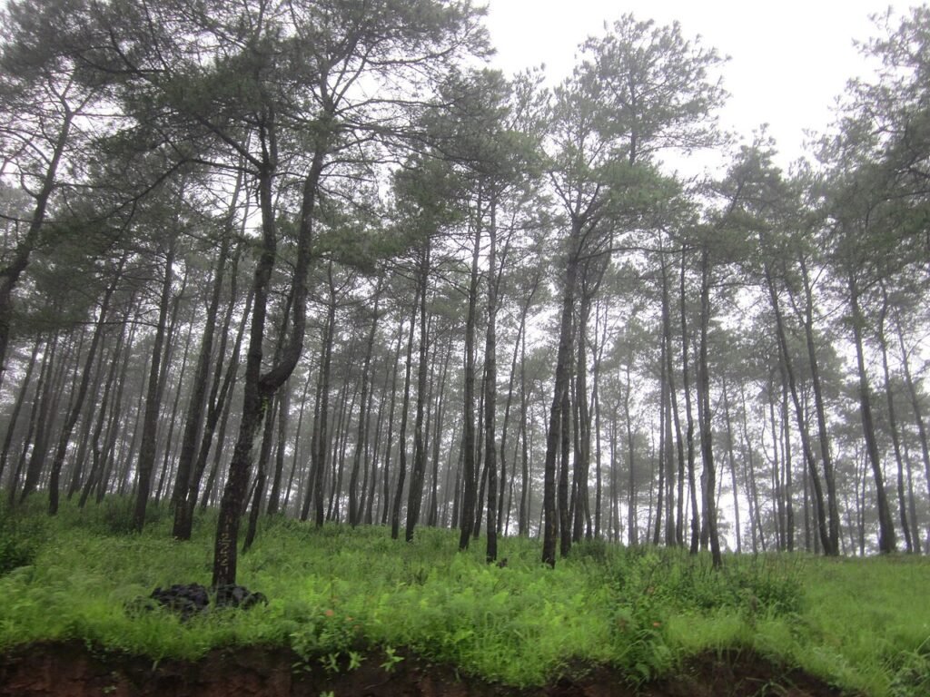
- Loss admitted: The State admits that 86.66 sq km of forest cover was lost from 2021 to 2023. The ISFR 2023 records this fall inside the Recorded Forest Area (RFA), which for Assam is mapped as the “Green Wash”.
- Long-term gain claimed: The government says the long-term trend is still positive. It points to a net gain of 748.65 sq km in forest cover since 2013.
- Dima Hasao hit hardest: The State blames traditional jhum (shifting) cultivation in Unclassed State Forest (USF) areas. The Forest Department does not directly administer these areas. The district also saw 95.55 sq km of forest land diverted for development between 2020 and 2025.
- Border districts: Cachar and Hailakandi each lost more than 16 sq km. The State blames encroachment from the Mizoram side of the border. In Chirang, it names encroachment by local communities.
- Regeneration argument: The State says more than 100 sq km was freed of encroachment but has not yet regrown. It wants this delay counted when the real loss is assessed.
- Amicus recommendations: The amicus wants a joint committee to study border encroachment. It would have the Union Environment Ministry, Survey of India and the Forest Departments of Assam and Mizoram. The amicus also asks for a USF policy made with local autonomous councils, closer checks on compensatory afforestation and livelihood support for jhum families.
Core Concepts & Static GK
- Forest cover: The ISFR counts all land of at least one hectare with tree canopy of at least 10 per cent as forest cover. Ownership and legal status do not matter. So an orchard or a plantation can count as forest cover.
- Tree cover: This means tree patches outside recorded forest areas that are smaller than one hectare, including scattered trees. The FSI estimates it by sampling, not by satellite mapping.
- Recorded Forest Area (RFA): This is land recorded in government records as Reserved Forest or Protected Forest. In the ISFR 2019, FSI noted that Assam had not supplied a digitised RFA boundary. It used a “Green Wash” of 27,547.84 sq km from Survey of India toposheets as a stand-in.
- Unclassed State Forest (USF): In Assam, this is the part of the recorded forest that is not Reserved Forest. In the ISFR 2019, Assam reported 26,832 sq km of RFA. Of this, 17,864 sq km was Reserved Forest and 8,968 sq km was Unclassed Forest. That is 33.42 per cent of the RFA.
- Jhum: Jhum is the local name for shifting cultivation. Patches of forest are cleared, farmed for some years and then left to regrow. The State’s affidavit names it as the main driver of loss in Dima Hasao.
- Compensatory afforestation: When forest land is diverted for a project, the user agency pays for planting trees elsewhere. The money goes into funds set up under the Compensatory Afforestation Fund (CAF) Act, 2016.
Constitutional & Legal Framework
- Godavarman definition: In T.N. Godavarman Thirumulpad (1996), the Supreme Court said “forest” must be read in its dictionary meaning. It also covers any area recorded as forest in government records, whatever its ownership. This is why unclassed forests still matter in law.
- 2024 interim order: On 19 February 2024, the Supreme Court told States and Union Territories to follow the Godavarman definition. This holds until they finish recording forest land under Rule 16 of the Van (Sanrakshan Evam Samvardhan) Rules, 2023.
- Sixth Schedule: The Sixth Schedule, linked to Articles 244(2) and 275(1), sets up autonomous district councils in tribal areas of Assam, Meghalaya, Tripura and Mizoram. Under its paragraph 3(1)(b), a district council can make laws on the management of any forest that is not a reserved forest.
- Dima Hasao council: The North Cachar Hills District Council was set up in April 1952 under Article 244(2) read with the Sixth Schedule. The district was renamed Dima Hasao on 30 March 2010, and the body now calls itself the Dima Hasao Autonomous Council.
- CAF Act, 2016: The Act creates a National Fund under the Public Account of India and a State Fund in each State or Union Territory. Both funds are non-lapsable and earn interest.
Institutional Machinery
- National Green Tribunal: The NGT took up the matter on its own (suo motu) after a media report based on the ISFR 2023. Its order of 22 January 2025 came from a bench led by Chairperson Justice Prakash Shrivastava. It made the Union Environment Secretary a party to the case. The forest chiefs (PCCFs) of Assam, Arunachal Pradesh, Tripura and Mizoram were also made parties.
- Amicus curiae: This means a friend of the court, an independent person who helps the tribunal. Here the amicus gave views on USF management and boundary disputes.
- Forest Survey of India (FSI): The FSI, under the Union Environment Ministry, prepares the ISFR every two years. The editorial wants it to add a decadal change analysis, so that short dips can be told apart from long trends.
- CAMPA authorities: The National Fund is managed by the National Compensatory Afforestation Fund Management and Planning Authority (CAMPA). Each State Fund is managed by the State CAMPA.
Reports, Indices & Data
- ISFR 2023: Union Environment Minister Bhupender Yadav released the report on 21 December 2024 at the Forest Research Institute, Dehradun.
- All-India picture: Total forest and tree cover is 8,27,357 sq km, or 25.17 per cent of India’s area. It rose by 1,445 sq km over the 2021 assessment.
- Assam picture: PTI’s report on the ISFR 2023 gives Assam a forest cover of 28,313.55 sq km, or 36.10 per cent of the State’s area. The NGT noted that canopy density inside Assam’s recorded forests had degraded over 1,699 sq km.
- Two different numbers: Reports speak of 83.92 sq km and 86.66 sq km. The first is the decrease reported for Assam as a whole, across all land. The second is the fall in forest cover inside the RFA/Green Wash only.
Assam & Northeast Linkages
- Assam-Mizoram border: Mizoram bases its boundary claim on the inner line notified in 1875 for the southern frontier of Cachar. Assam relies on the 1933 demarcation. Cachar and Hailakandi, two districts where the State reports forest loss, lie along this border.
- 2021 clash: On 26 July 2021, the police forces of the two States clashed at Lailapur in Cachar and Vairengte in Mizoram. Six Assam Police personnel were killed.
- Wider Northeast: The NGT case also covers Arunachal Pradesh, Tripura and Mizoram, so the issue is regional, not only Assam’s.
Prelims Trap Zones (Watch out for)
- Number Trap: 86.66 sq km is the fall in forest cover inside the Recorded Forest Area. 83.92 sq km is the decrease reported for the whole State. Do not swap them.
- Period Trap: The loss is for 2021 to 2023. The 748.65 sq km gain is counted since 2013.
- Control Trap: USFs are not run directly by the Forest Department. They are not Reserved Forests either.
- Definition Trap: Forest cover needs at least one hectare and at least 10 per cent canopy. Tree cover is made of patches smaller than one hectare outside recorded forest areas.
- District Trap: Dima Hasao is linked to jhum in USFs, Cachar and Hailakandi to Mizoram border encroachment, and Chirang to encroachment by local communities.
- Schedule Trap: Forest powers of autonomous councils come from paragraph 3 of the Sixth Schedule, not the Fifth Schedule. They cover forests that are not reserved forests.
Introduction
The ISFR 2023 shows that Assam lost 86.66 sq km of forest cover inside its recorded forests from 2021 to 2023. The State replies that it has gained 748.65 sq km since 2013. Now before the National Green Tribunal, the case shows that counting forest is easy but managing land that no single agency controls is hard.
Underlying Drivers of the Decline
- Jhum in Dima Hasao: The State says traditional shifting cultivation in USF areas caused much of the loss in Dima Hasao, the worst-hit district. Cleared plots show up as lost canopy until they regrow.
- Diversion for development: Dima Hasao saw 95.55 sq km of forest land diverted for development projects between 2020 and 2025. This is a planned, legal loss, unlike encroachment.
- Cross-border encroachment: Cachar and Hailakandi each lost more than 16 sq km. The State blames settlers coming in from the Mizoram side.
- Local encroachment: In Chirang, the State names encroachment by local communities as a major factor.
- Slow regrowth: More than 100 sq km freed of encroachment has not regenerated yet. Satellite maps count such land as non-forest until its canopy returns.
- Measurement rule: The ISFR counts land with at least 10 per cent canopy as forest, whatever its status. A fall can therefore come from thinning canopy as well as from clearing.
Governance Gaps Behind the Numbers
- Weak control over USFs: The amicus found that the State has little power to manage Unclassed State Forests. In the ISFR 2019, a third of Assam’s recorded forest, 8,968 sq km, was in this category.
- Unresolved boundaries: Disputes between States make it hard to monitor land or act on encroachment. The Assam-Mizoram dispute rests on two colonial-era lines, of 1875 and 1933.
- Missing RFA map: In the ISFR 2019, FSI noted that Assam had not given it a digitised boundary of its recorded forests. FSI used a Green Wash from Survey of India toposheets instead, and the ISFR 2023 still reports Assam under the RFA/Green Wash category.
- Council areas: Dima Hasao is a Sixth Schedule district, and its council can make laws on forests that are not reserved forests. The Forest Department cannot act alone there, so the amicus wants any USF policy made with the councils.
- Numerical targets: The amicus wants compensatory afforestation judged by how many native saplings survive and how far the ecosystem recovers. Merely meeting planting targets is not enough.
- Data limits: FSI reports come every two years. The editorial wants a decadal change analysis added, to tell temporary dips from lasting trends.
Challenges
- Livelihood dependence: Families practising jhum depend on it for food. Stopping it without alternatives would hurt them, so the amicus stresses sustainable farming and other livelihoods.
- Competing development needs: Roads, power lines and other projects keep asking for forest land. The 95.55 sq km diversion in Dima Hasao between 2020 and 2025 shows the scale.
- Inter-State tension: On 26 July 2021, a clash at Lailapur and Vairengte killed six Assam Police personnel. It shows how a boundary issue can turn violent. A joint forest survey with Mizoram will need trust on both sides.
- Dispute over the baseline: The State argues that a long-term gain of 748.65 sq km outweighs the recent loss. Critics can reply that the loss is inside legally recorded forest, which is the better-protected land.
- Legal uncertainty: Under the Supreme Court’s order of 19 February 2024, States must use the Godavarman definition until their forest records are complete. Until then, agencies can read the status of unclassed land differently.
- Quality of compensation: Planting trees elsewhere does not replace an old natural forest. Without survival checks, compensatory planting may exist only on paper.
Way Ahead
- Joint border committee: The Union Environment Ministry, Survey of India and the Forest Departments of Assam and Mizoram should jointly examine border encroachment. The committee should then propose corrective steps, as the amicus suggests.
- USF policy: Assam should frame a dedicated policy to bring USFs under sustainable management. It should be made together with the autonomous councils, which hold law-making power over non-reserved forests.
- Better compensatory afforestation: The State CAMPA should track plantation survival and prefer native species. Success should be measured by restoration, not by planting targets.
- Jhum support: The Agriculture and Forest departments should offer sustainable farming methods and alternative livelihoods to jhum families. This lowers the pressure to clear fresh forest.
- Technology monitoring: Satellite and field monitoring should flag clearing early. A digitised RFA boundary given to FSI would show exactly where loss happens.
- Decadal analysis: FSI should add decadal change assessments to its two-yearly reports. This would separate short dips from long-term trends.
Conclusion
The numbers show a long-term gain, but the recent loss inside recorded forests points to land that nobody fully manages. Assam will protect its forests only if Unclassed State Forests get a clear manager, boundary disputes are settled and hill communities share the work.
Asked in APSC
- APSC Prelims 2025: (answer in the MCQs below)
According to the India State of Forest Report, 2023, which North-Eastern State has the highest percentage of forest cover in relation to its total geographical area?- (A) Manipur
- (B) Assam
- (C) Mizoram
- (D) Arunachal Pradesh
- APSC Prelims 2025: (answer in the MCQs below)
With reference to the forest cover of India, consider the following statements:
1. Madhya Pradesh has the largest forest cover in terms of area.
2. Mizoram has more than 80% forest cover.
3. India State of Forest Report (ISFR), 2023 reports that India’s total forest cover is about 21.76% of the country’s total geographical area.
4. India’s forest cover is unevenly distributed across States.
Select the correct answer using the codes given below.- (A) 1, 2, 3 and 4
- (B) 1, 3 and 4 only
- (C) 2 and 4 only
- (D) 2, 3 and 4 only
All 500 APSC Prelims PYQs of CCE 2020 to 2025, with answers and explanations: practise free in the PYQ Explorer
APSC Prelims MCQs
Practice questions on this topic
Q1. The Assam government has told the National Green Tribunal about forest loss in the State. Consider the following statements about the district-wise reasons it gave:
(i) Jhum cultivation in Unclassed State Forest areas was blamed for much of the loss in Dima Hasao.
(ii) The decline in Cachar and Hailakandi was linked to encroachment from the Mizoram side of the border.
(iii) The decline in Chirang was linked to forest land diverted for hydropower projects.
Which of the statements given above is/are correct?
- (a) (i) only
- (b) (i) and (ii) only
- (c) (ii) and (iii) only
- (d) (i), (ii) and (iii)
Show answer
Answer: (b) Explanation: Statements (i) and (ii) match the State’s affidavit to the NGT. It blamed traditional jhum farming in Unclassed State Forest areas for much of Dima Hasao’s loss. It linked declines of more than 16 sq km each in Cachar and Hailakandi to encroachment from the Mizoram side of the border. Statement (iii) is wrong because the State named encroachment by local communities in Chirang, not hydropower diversion. The 95.55 sq km diversion for development between 2020 and 2025 was reported for Dima Hasao. So options (a), (c) and (d) fail. Value addition: paragraph 3(1)(b) of the Sixth Schedule lets an autonomous district council make laws on managing any forest that is not a reserved forest.
Q2. Consider the following statements about forest data in the India State of Forest Report (ISFR):
(i) Forest cover includes land of at least one hectare with tree canopy of at least 10 per cent, regardless of ownership.
(ii) Tree cover means tree patches smaller than one hectare outside recorded forest areas.
(iii) The ISFR 2023 was released on 21 December 2024 and shows a fall in India’s total forest and tree cover.
Which of the statements given above is/are NOT correct?
- (a) (i) only
- (b) (ii) only
- (c) (iii) only
- (d) (ii) and (iii) only
Show answer
Answer: (c) Explanation: Statement (iii) is not correct. The ISFR 2023 was released on 21 December 2024 in Dehradun, but it showed a rise, not a fall, in total forest and tree cover. The total is 8,27,357 sq km, which is 25.17 per cent of India’s area and 1,445 sq km more than in 2021. Statements (i) and (ii) are correct, because they give the report’s definitions of forest cover and tree cover. So options (a), (b) and (d) wrongly mark a correct statement as incorrect. Value addition: the Recorded Forest Area covers land recorded as Reserved Forest or Protected Forest. Assam’s fall of 86.66 sq km was measured inside it.
Q3. Match List-I with List-II (as stated in the Assam government’s response to the NGT):
| List-I | List-II |
|---|---|
| a. Dima Hasao | 1. Encroachment by local communities |
| b. Cachar and Hailakandi | 2. Jhum cultivation in Unclassed State Forest areas |
| c. Chirang | 3. Encroachment from the Mizoram side of the border |
| d. Forest land diverted for development in Dima Hasao, 2020 to 2025 | 4. 95.55 sq km |
Select the correct answer using the codes given below:
- (a) a-2, b-3, c-1, d-4
- (b) a-2, b-1, c-3, d-4
- (c) a-3, b-2, c-1, d-4
- (d) a-4, b-3, c-1, d-2
Show answer
Answer: (a) Explanation: Dima Hasao is linked to jhum cultivation in Unclassed State Forest areas (a-2). Cachar and Hailakandi, which each lost more than 16 sq km, are linked to encroachment from the Mizoram side of the border (b-3). Chirang is linked to encroachment by local communities (c-1). The diversion of forest land for development in Dima Hasao between 2020 and 2025 was 95.55 sq km (d-4). Option (b) swaps the Mizoram and local-community causes. Option (c) swaps the causes for Dima Hasao and the Cachar-Hailakandi pair. Option (d) puts the figure against Dima Hasao and the jhum cause against the diversion. Value addition: the State also reports a net gain of 748.65 sq km in forest cover since 2013.
Q4. Which set of bodies did the amicus curiae recommend for a joint committee to investigate border encroachment on forest land between Assam and Mizoram?
- (a) Union Environment Ministry, Survey of India, and the Forest Departments of Assam and Mizoram
- (b) Union Home Ministry, Geological Survey of India, and the Revenue Departments of Assam and Mizoram
- (c) Forest Survey of India, North Eastern Council, and the Governors of Assam and Mizoram
- (d) Union Environment Ministry, Wildlife Institute of India, and the Autonomous Councils of Assam
Show answer
Answer: (a) Explanation: The amicus curiae report to the NGT proposed a joint committee. It would have the Union Environment Ministry, Survey of India and the Forest Departments of Assam and Mizoram. The mix fits the task, because the work needs both forest records and boundary mapping. Option (b) names the Home Ministry, Geological Survey of India and the revenue departments, none of which were proposed. Option (c) brings in the North Eastern Council and the Governors, who were not named. Option (d) adds the Wildlife Institute of India and leaves out Mizoram and Survey of India. Value addition: the 1875 inner line, which Mizoram treats as its boundary with Assam, ran along the southern frontier of Cachar district.
PYQ (APSC Prelims 2025): According to the India State of Forest Report, 2023, which North-Eastern State has the highest percentage of forest cover in relation to its total geographical area?
- (A) Manipur
- (B) Assam
- (C) Mizoram
- (D) Arunachal Pradesh
Show answer
Answer: (C) Explanation: According to the India State of Forest Report (ISFR) 2023, the 18th biennial report of the Forest Survey of India (released by the Ministry of Environment, Forest and Climate Change in December 2024), Mizoram has 85.34% of its geographical area under forest cover. This is the highest among all States (and among North-Eastern States); only the Union Territory of Lakshadweep (91.33%) is higher overall.
Read the full explanation, with all APSC Prelims Environment PYQs
PYQ (APSC Prelims 2025): With reference to the forest cover of India, consider the following statements:
1. Madhya Pradesh has the largest forest cover in terms of area.
2. Mizoram has more than 80% forest cover.
3. India State of Forest Report (ISFR), 2023 reports that India’s total forest cover is about 21.76% of the country’s total geographical area.
4. India’s forest cover is unevenly distributed across States.
Select the correct answer using the codes given below.
- (A) 1, 2, 3 and 4
- (B) 1, 3 and 4 only
- (C) 2 and 4 only
- (D) 2, 3 and 4 only
Show answer
Answer: (A) Explanation: As per the India State of Forest Report (ISFR) 2023, released on 21 December 2024 by the Forest Survey of India, Dehradun:
Read the full explanation, with all APSC Prelims Environment PYQs
Prepare with SuchitraACS
APSC CCE Foundation Programme₹24,999  APSC Prelims Crash Course 2027 (GS + CSAT)₹5,999
 APSC Prelims PYQ Book 2020-2025 (PDF)₹199See the book